Retracing the Old Silk Road, Tajikistan
To many across the globe, Tajikistan might sound remote. And same is the case with the Indians. But this Central Asian country is closer to India than the Indians think. To give a perspective, Delhi to Dushanbe, Tajikistan via Afghanistan is less than 2000 km while Delhi to Chennai is 2200 Kms. If India had retained Gilgit-Baltistan post-independence, there would have been a direct route (bypassing Pakistan) to Tajikistan through the Irshad pass to the Wakhan Corridor in Afghanistan and into the Wakhan Corridor in Tajikistan.
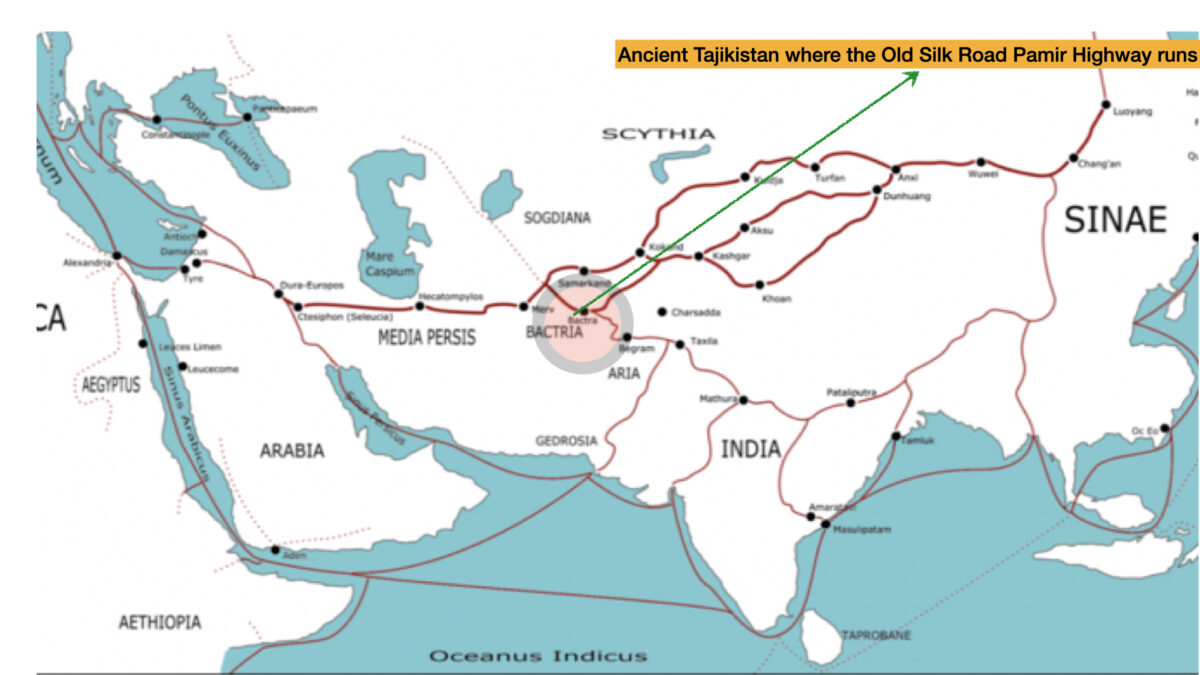
During ancient times, caravans for centuries had passed through this land as this land was part of the old silk road. Merchants from ancient India took their spices and jewels through this land to Central Asia. The Indian city of Indraprastha (Delhi) on Yamuna, the tributary of the Ganges River is the place where spices and jewels and other products begin their journey north and west running through this land all the way to Rome.
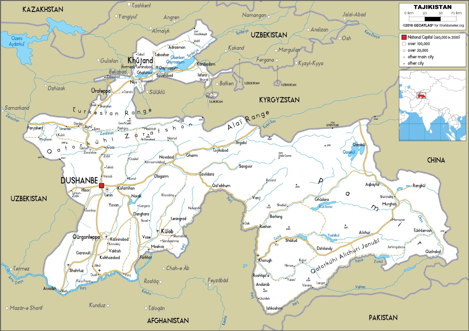
To provide a brief background, Tajikistan is located in Central Asia. Historically, this region was part of Bactria. The Zoroastrian religion most likely originated from here. This region was ruled by the Indianized Kushan dynasty till the 5th CE.
In the 16th century, Babar had traveled from the Ferghana Valley, Uzbekistan to India to establish the Mughal Empire through Badakhshan. Today, the land of Badakhshan is split between Tajikistan, China and Afghanistan. Badakhshan in Tajikistan is called the Gorno-Badakhshan Autonomous region (GBAO) of Tajikistan. The country was part of the Soviet Union before it got independence in 1991 when the Soviet Union collapsed.
India and Tajikistan share a close relationship and India Air Force operated out of Ayni and Farkhor air bases post Tajikistan independence.
This hallowed history piqued my interest. And travel is therapeutic, especially the experience you come across. I needed that to heal from the pandemic enforced confinement at home. So it took me along with my friend to Tajikistan and Uzbekistan in July of 2021. I made plans to drive through the Pamir Highway, which was part of the old silk road. The Pamir highway connects Afghanistan, Pakistan, Kyrgyzstan, Uzbekistan and Tajikistan. Cities such as Mazar-I-sharif in Afghanistan, Dushanbe, Khorog in Tajikistan, Osh in Kyrgyzstan, Termez in Uzbekistan line up this highway.
The Pamir Highway from Dushanbe to Osh, Kyrgyzstan is called M41. It passes through the autonomous region called Gorno-Badakhshan Autonomous Region.
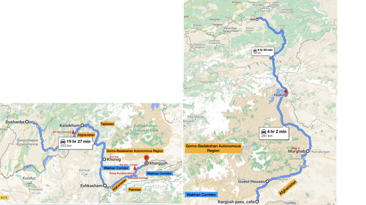
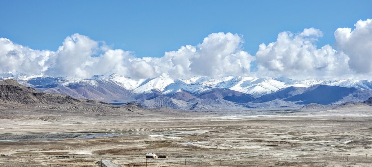
The plan was to start from Dushanbe to Osh, Kyrgyzstan through the Pamir Highway (refer to the map above) . This is one of the highest international roads in the world. I added a detour into the Wakhan corridor as I wanted to see the Yamchun fortress in Ishkashim and Buddhist stupa in Vrang village. Also the detour has some of the beautiful scenery. The route runs for 200 km along the Afghanistan border separated by the Panj river. At some places, the river is just 20 feet wide and one can cross into Afghanistan.
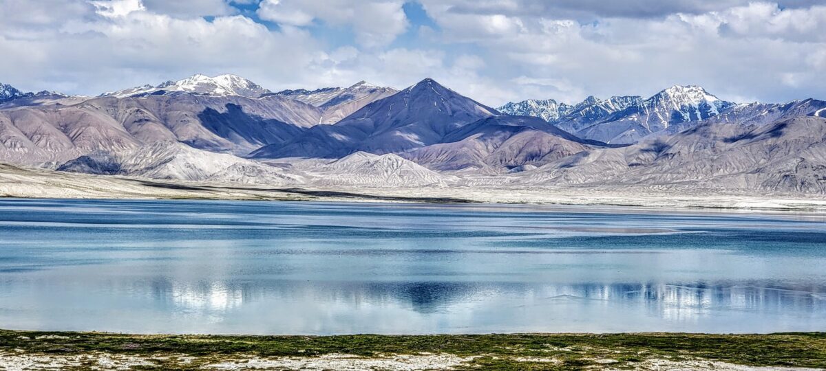
But due to the COVID situation, the land border was closed between Tajikistan and Kyrgyzstan near Osh. So we decided to stop at Karakul lake on the Tajikistan side on the border of Kyrgyzstan instead of crossing into Kyrgyzstan. From Karakul, we planned to drive through the Bartang valley back to Dushanbe. My friend and I rented a Nissan Patrol with an extra gas tank as the places we planned on riding through were remote and gas stations would not be available.

Dushanbe to Kalaikhum – Day 1
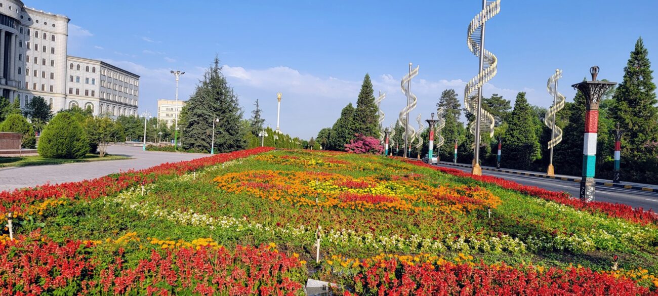
Along with my friend, I flew into Dushanbe, the capital of Tajikistan in July 2021. After the seamless immigration process and the mandatory COVID19 test at the airport, I checked into a hotel. After refreshing, we picked up the 4×4 SUV, Nissan Patrol, from a tour operator who we had communicated with prior to our trip.
By the time we loaded the SUV with provisions, a few Vodka, beer bottles, cans of water, changed some currency and bought mobile simcard, we were delayed in our trip. But I want to digress to share an experience. As we went to get the provisions from the departmental store in the Dushanbe mall, we came across an Australian couple and exchanged pleasantries and found they were heading to Pamir. Coming back, I saw a note in the car with their contact info asking us to contact them. We networked and exchanged information in WhatsApp for the next few days even into Uzbekistan. Every bit of info was valuable- -COVID test locations, turnover times, Tajikistan-Uzbekistan border crossing information, homestays All new information was gold during those difficult situations
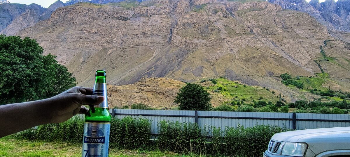
The drive from Dushanbe is on a paved road where one can drive at 100 km but after 100 kms, the road turned into a dirt road. You have to reach Kalaikhum before sunset to have accommodation as there are no hotels/ homestays before Kalaikhum. It takes about 6 hours from Dushanbe to Kalaikhum and we had taken a mountainous route instead of the paved M41 through the city of Kulob. And driving after sunset is not an option due to the treacherous mountain road. We failed to do that after 4 hours of journey and decided that we will camp somewhere in the wild. We were traveling in the month of July and is the best time of the year to travel as the weather was warm.
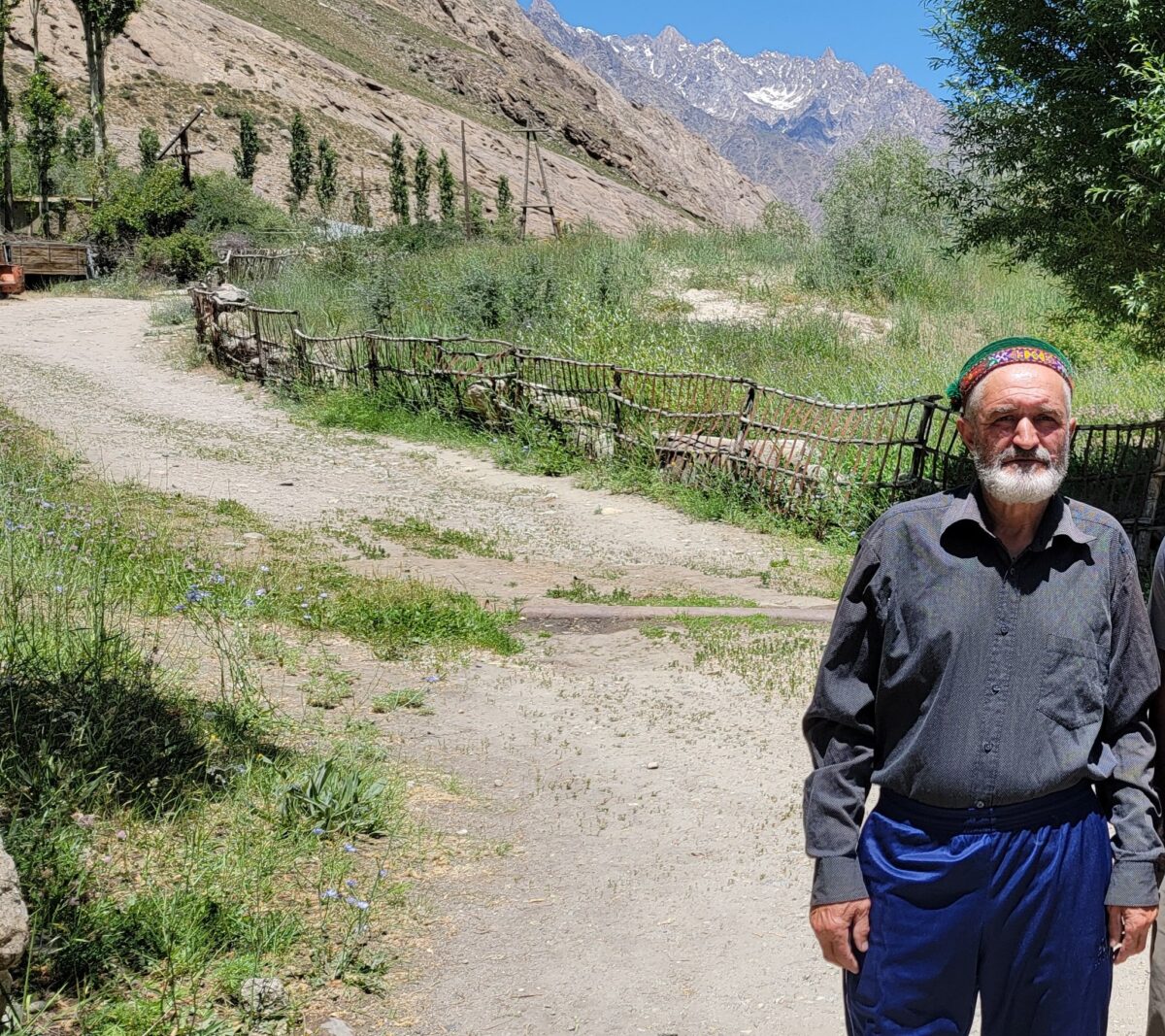
This is where we got a taste of the excellent Tajikistan hospitality. Before we camped we weren’t sure if the place was safe. We stopped a villager who insisted that we go with him to his home and stay for the night. As the language was an issue, he called his friend in his phone, who spoke English and translated it for us. For 10 mins, he persisted stating that we are Memon ( guests from god). Once we came to know the place is very safe, we felt we would camp by the river as we had the inexpensive Vodka and beer, we had bought earlier. He left reluctantly and then he came back. He asked, ” Do you have food? I will bring it”. We had bought some snacks and cookies and we felt we should be fine. We slept in the open with one sleeping bag but the weather was pleasant though by early morning, the temperatures started hurting the toes. We woke up early and started our journey ahead as we had to travel to Kulob beyond Kalaikhum
Kalaikhum to Khorog – Day 2
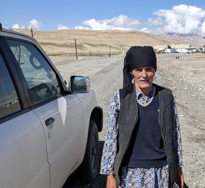
The total trip was more than 7 hours and one can’t drive above 40 kms speed in these parts due to road conditions. The roads started getting treacherous before Kalaikhum . The road was very narrow with a deep ravine on one side with the Panj river flowing below. But this was the best part of the trip. The landscape started getting better when we were stopped by 3 ladies and a child looking for a ride. As we were touched by the hospitality the previous evening, we wanted to pay forward the kindness we received. It was also an opportunity to converse with the locals and understand their culture. The language was a big barrier. Majority of the people of Tajikistan speak Tajik or different dialects of Pamiri language or Kyrgyz. And many people speak Russian. But we managed using Google translate and were able to have basic conversations. People around Dushanbe spoke Tajik as they were Tajiks. But as you enter Kalaikhum, the people were Pamiris.
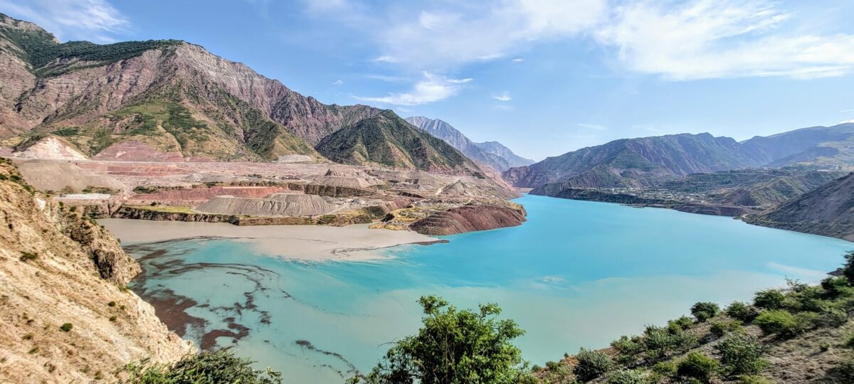
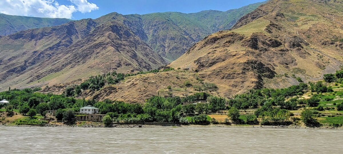
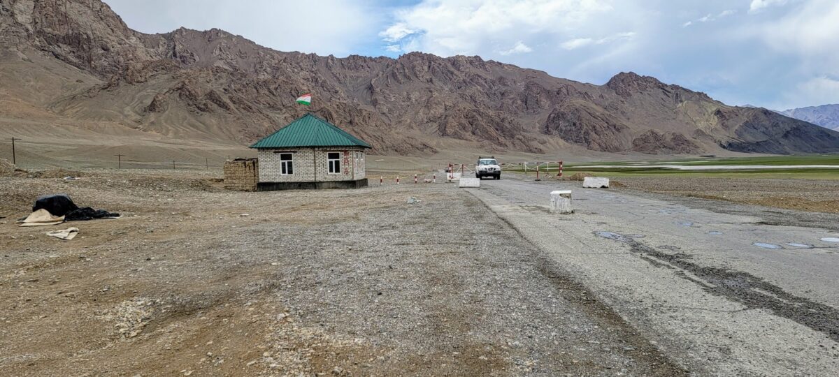
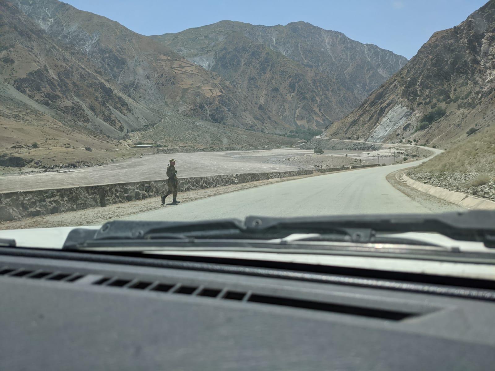
Kalaikhum signals the beginning of the Gorno-Badakhshan Autonomous Region (GBAO). One would need a GBAO permit issued along with a Tajikistan visa to enter this region. Multiple Military checkpoints in different locations of GBAO check and collect a copy of the GBAO permit. The soldiers were friendly and never faced a harassment in the 12 odd check posts we encountered throughout our trip. This is also where the Panj river separates Afghanistan and Tajikistan and the Pamir highway runs closer to the Afghan border from here onwards.
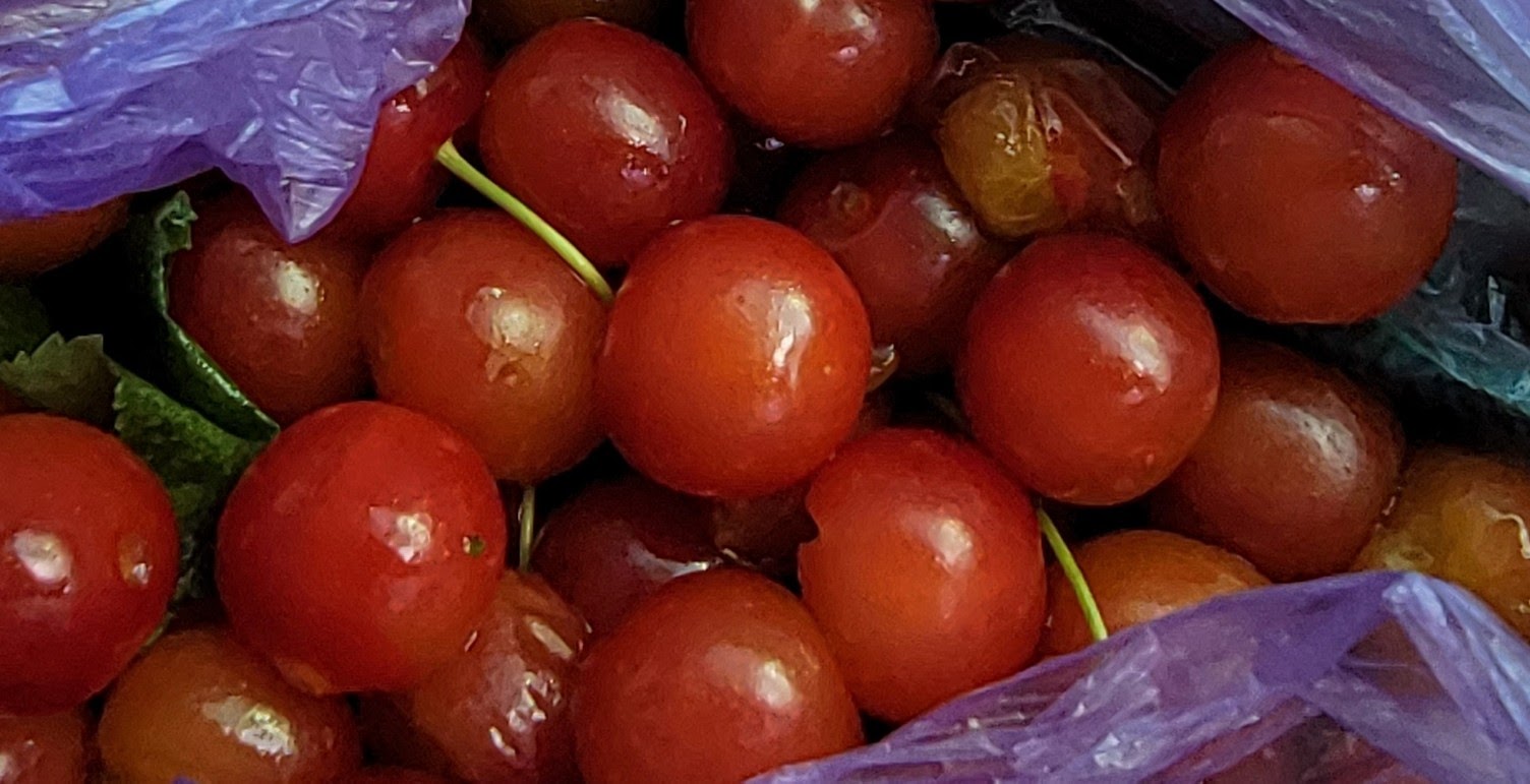
The ladies were Pamiris who spoke Shughni dialect of Pamiri. They gave us berries and invited us for Chai (tea) to their home at Kalaikhum. Throughout the next few days, we stopped by whenever people waved at us seeking a ride. We curiously posed our questions around culture and language to them. There is no public transportation in these parts and the cars passing by offer them rides. Many invited us for Chai to their homes but we declined all invitations except for one, an invitation from a policeman.
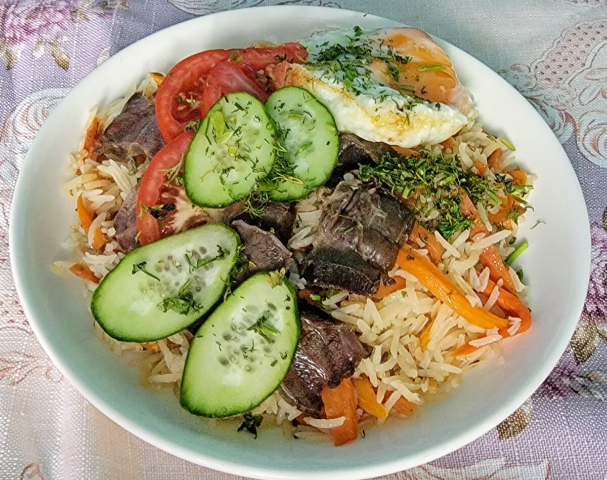
We got our breakfast and got provisions including chocolate and cookies for the Pamiri kids who would wave at us enthusiastically as we drive past them. The distance from Kalaikhum to Khorog is about 240 kms. But the road was fine but scenery turned into a desolate desert with the Panj river and the Afghanistan border keeping company throughout. There were no eateries after we left Kalaikhum but we had packed some egg dishes and Tajik breads in Kalaikhum and we had them somewhere sitting on the banks of the Panj river looking at Afghanistan. Little did we know that this area will be taken over by the Taliban in the next few days.

We reached Khorog before sunset. Khorog is the capital of GBAO. The women here would give a run to those from New York when it came to the sense of fashion. As we entered Khorog, our SUV broke down. We asked a few guys sitting there to help find a garage. But one of them found out there was a loose connection in the battery and fixed it within minutes. Though the issue was sorted out, it cast a doubt in me, which had a direct bearing on my the trip (covered later).

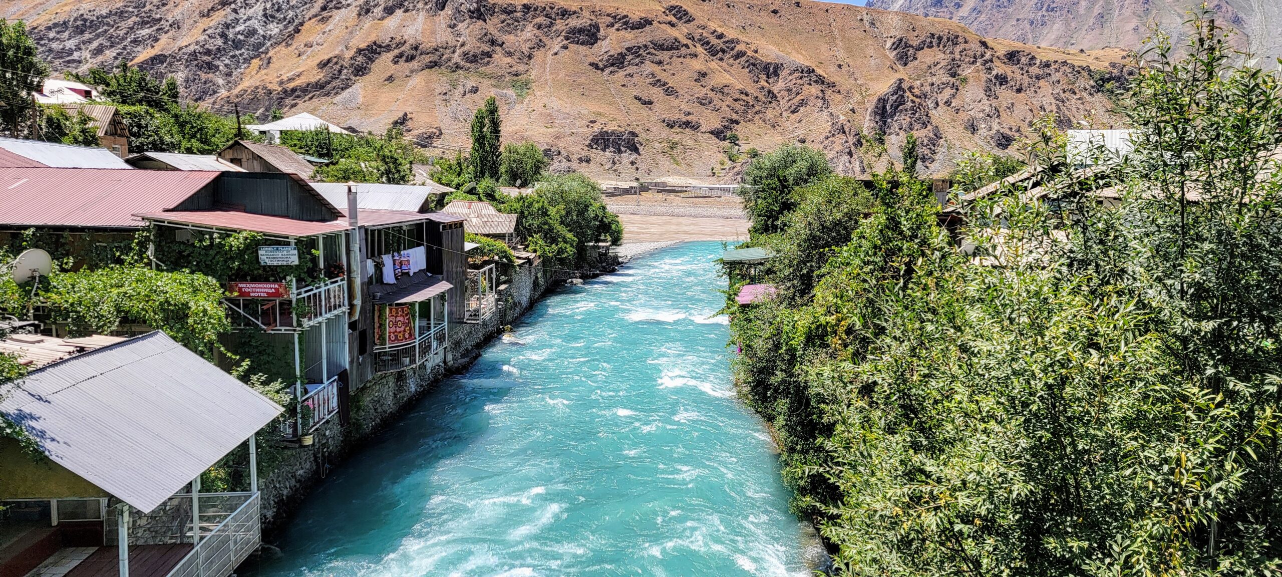
We rented a room in a homestay overlooking the Panj river in Khorog. Interestingly they charge by the bed in these homestays and not by the room you rent.
Khorog to Langar – Day 3
Each day we left early in the morning. We would take our breakfast very early in the morning to cover as much distance as we could and spend time in between to explore the landscapes Especially the 3rd day, there were a couple of places we wanted to cover. The first one was the 2nd BCE Kushan fortress called Yamchun fortress. Close to Yamchun fortress was the Vrang Buddhist Stupa dating back to 6th CE.

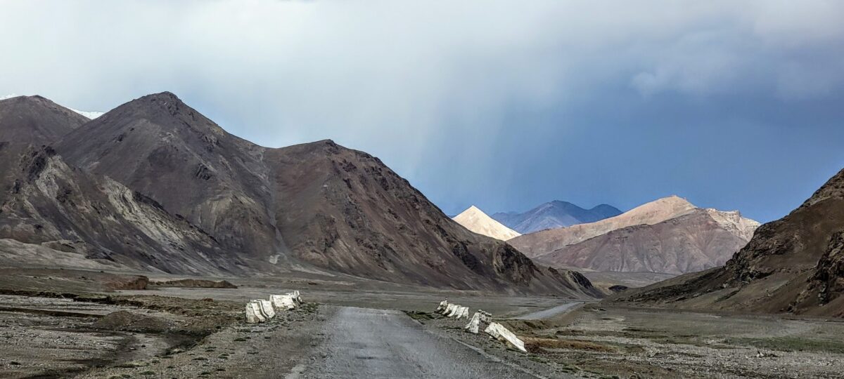
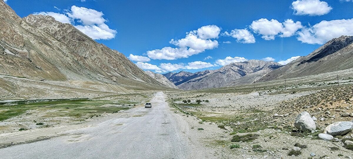
That day, we did not have an idea on where we would sleep for the night. We decided we will make a call that evening an hour or two before the sunset. We had entered into the Wakhan corridor and the roads were not paved with small rocks now and then on the road with the agricultural fields on both sides beyond which were the icy mountains. The ride was not treacherous unlike the previous day.
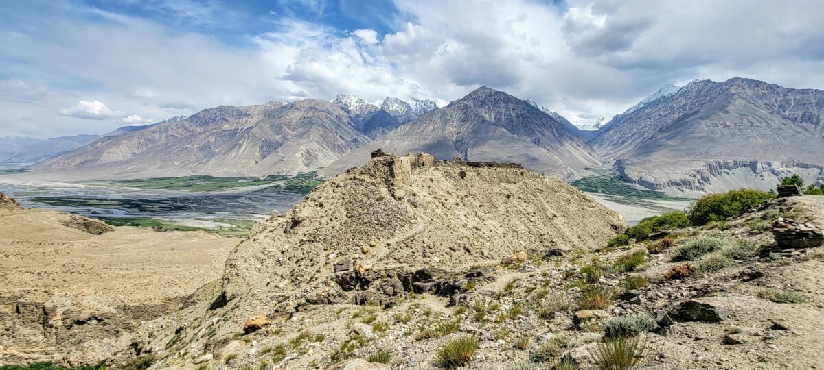
But the dirt road up the hill where the Yamchun fortress was located was challenging to drive as there were barely a few inches left on either side of the SUV’s wheels. And the road climbing up the hill was steep with a deep ravine on one side. The remnants of Yamchun fortress was a disappointment to me as I was expecting it to be preserved by the Government. Nevertheless, the sweeping view from the fortress was mesmerizing. The fortress overlooks the Wakhan corridor of Afghanistan separated from Tajikistan by the Panj river. Afghanistan is at the narrowest here bordered by the Hindu Kush range in Pakistan on the other side. The Hindu Kush range is visible from here. The fortress also houses a Zoroastrian fire temple.
Near to Yamchun fortress is Bibi Fathima hot springs which we decided to skip due to the pandemic situation as we didn’t want to be among the crowd.
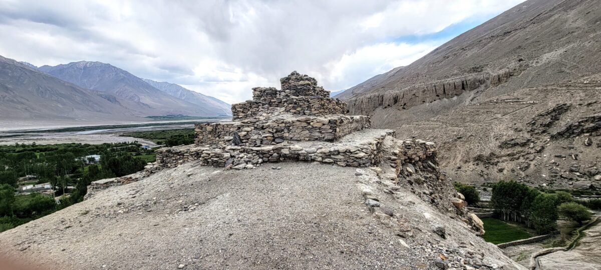
Few kms from here was the Vrang Buddhist Stupa on a hill. Buddhist monks, like in India, were living in caves, which were visible. The climb was steep as I was gasping for breath or maybe the altitude posed a problem for me. Vrang is located at an altitude of 9000+ feet above sea level. The stupa is in ruins and only mud remnants in the form of steps remain.

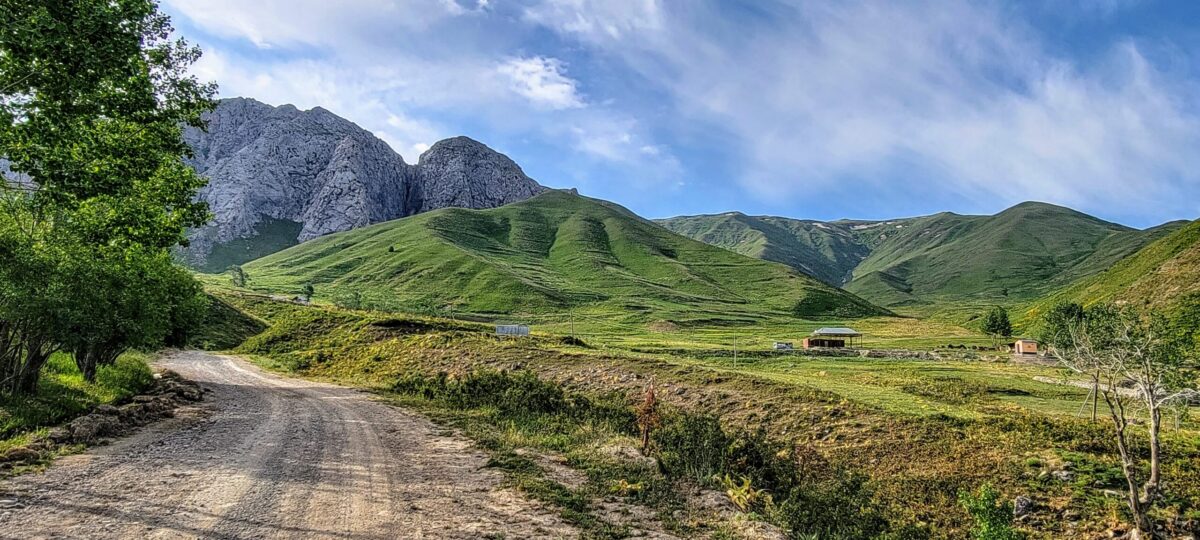
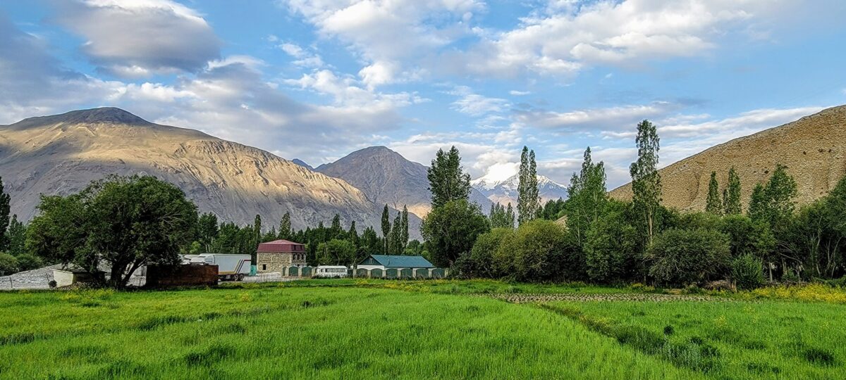
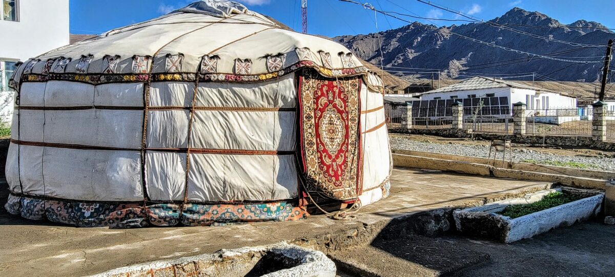
As we drove for another hour, we came across a Homestay located in Langar. The location was beautiful (pictures) and we could see that the homestay was frequented by many motorcycle riders, from Nepal, US and other places as seen by the stickers on the door.
The homestay was empty and we were the only guests for the night. Found out from the owner of the homestay, the pandemic has driven down the business. I started conversing with the daughter of the owner of the homestay, who should be just 19 years of age. She spoke to me about her dreams of traveling the world conversing with me in English, while her mom watched her with pride. She was studying tourism and economics in a University in Dushanbe. She gave me an insight into Pamiris, their culture and religious practices. Tajiks are Sunnis while Pamiris, who identify themselves with Persians, belong to the Shia sect of Islam except for a few. The residents of Badakhshan cherish their freedom.

Langar to Murghab – Day 4
Next day as we were leaving very early in the morning, the homestay owner tried calling her daughter over the phone. Their house was away from the homestay. She couldn’t reach the girl. She got our contact info from us for her daughter. The incident is insignificant but it established to me along with their dresses that Pamiris were more modern than I had previously imagined.
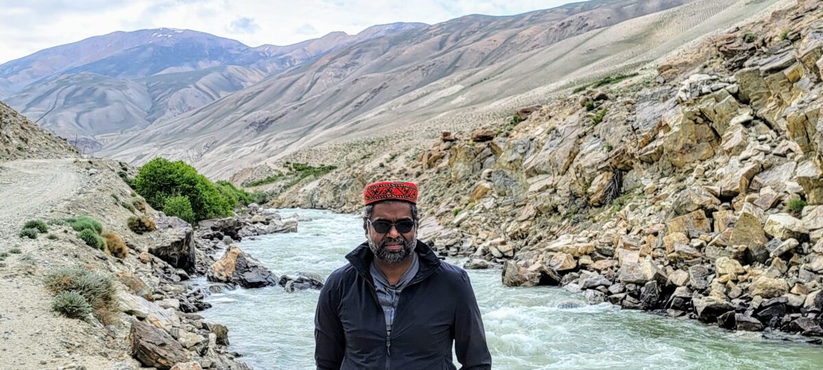
The drive on day 4 was through the remote no man’s land but still bordering Afghanistan. We hardly came across anyone for the 50+ km stretch. After my experience in Khorog, the thought of the SUV stopping did cross my mind. But the scenery with ice-clad mountains, the Panj river and the high altitude desert, was refreshing. In some places, the Panj river was just 20 feet wide and I could have crossed into Afghanistan if I wanted.
There were no roads here but only trails and we followed one of the trails which started to climb up from this point onwards and ran through the Khargosh pass. The pass is at an altitude of 4350 meters or 14200 feet above sea level. But I did not face any altitude related sickness as I had taken precautions (started with the Altitude sickness pill 2 days before I started the trip). But this is where the trail runs away from the Afghanistan border.

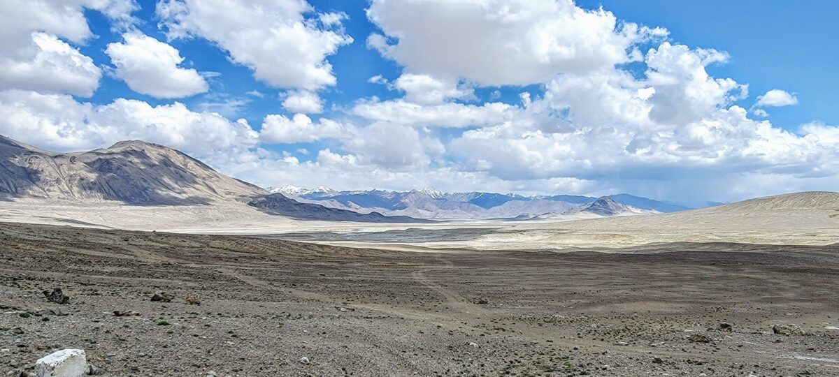
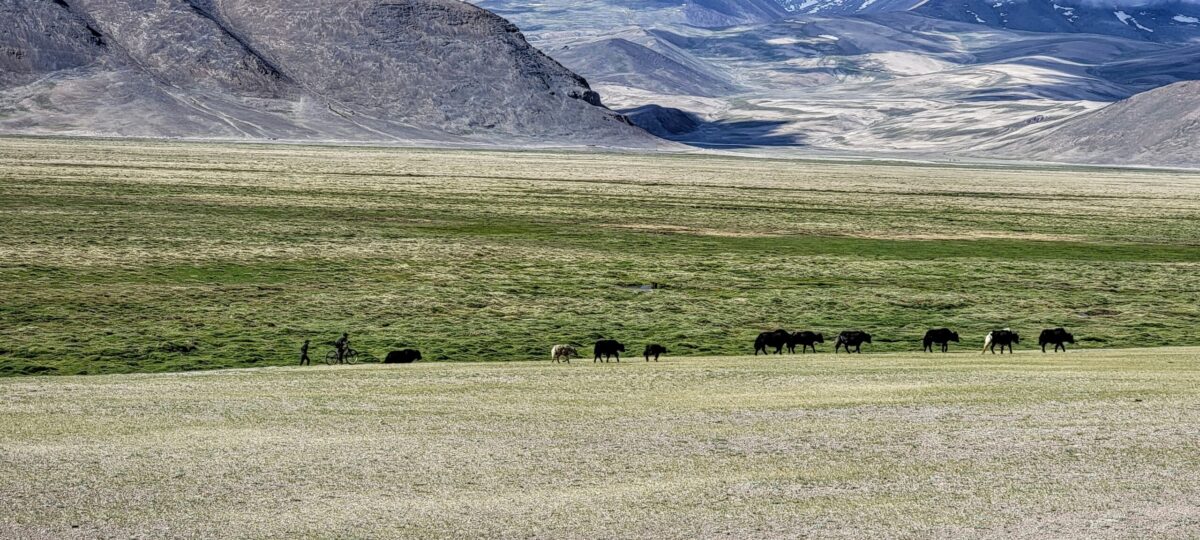
After the Khargosh pass, the trail joins the M41 or the Pamir highway, which is paved, just before the town of Alichur. We reached Murghab, a city developed during the Soviet-era for lunch. Murghab is the highest town in Tajikistan. And I noticed the demographics have changed. The city is populated by mainly Kyrgyz people who belong to the Mongoloid stock.

After our lunch, as we touched Ak-Baital pass which is the highest point in the Pamir highway at 4,655 meters (15,272 ft), we made a decision not to head to Karakul lake. The original plan was to stay overnight in Karakul and head to Rashon, a city between Khorog and Dushanbe through an alternate northern route through Bartang valley. Bartang valley is remote even compared to the route through the Khargosh pass and there are only trails with no roads. The car rental guy had warned us that if we were stuck at Bartang valley, it would take 2 days for the help to reach us. The experience of the battery disconnecting for a few minutes in Khorog weighed in my mind and I made a call to take the M41 back to Dushanbe much to the disappointment of my friend.
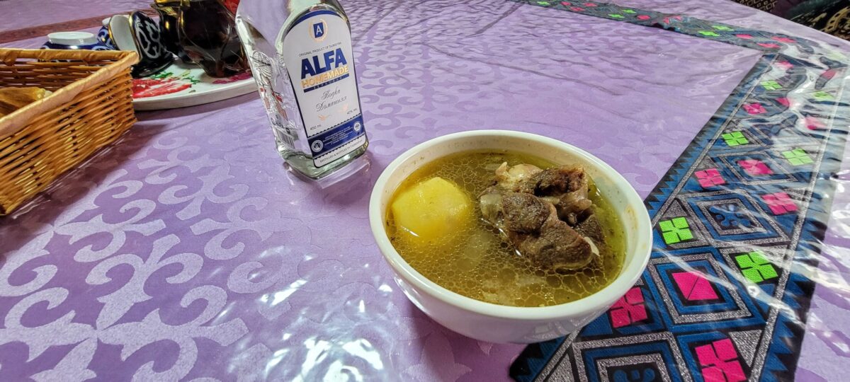
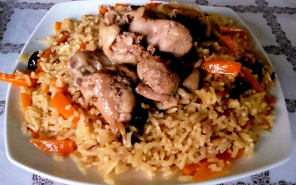
Dinner at the hotel with a home distilled Vodka and Kyrgyz Yak Shorpo
We had spoken to a girl in Murghab,, when we went to make photocopies of the GBAO permits in a home stay in Murghab, when we stopped for lunch. She was studying to be a doctor in an University in Urumqi, Xinjian, China. She had suggested a hotel she was working in as the hotel manager as it was her break from her University. We turned back to stay overnight at that hotel in Murghab. This also was an excellent opportunity to converse about the country, her take and the culture.
The girl was born to a Uighur father and Kyrgyz mother and spoke flawless English. She stated she can converse well in Mandarin, Russian, Tajik and Kyrgyz languages. I whipped up a conversation with her and she shared some insights about Urumqi and Xinjian. She was kind enough to accompany me across the street to the grocery store too so she can translate for me. The weather was cold even in the summer month of July and the Vodka to go with the food was a welcome change. I got to converse with a Tajik Engineer from Dushanbe who worked for a Chinese construction company. Murghab is near the Chinese border. Heard from him, Chinese are involved in developing that part of Tajikistan and also involved in the expansion of the M41. Personally, I started to get the feeling that the Pamir highway trip was nearing the end as I hit the bed.
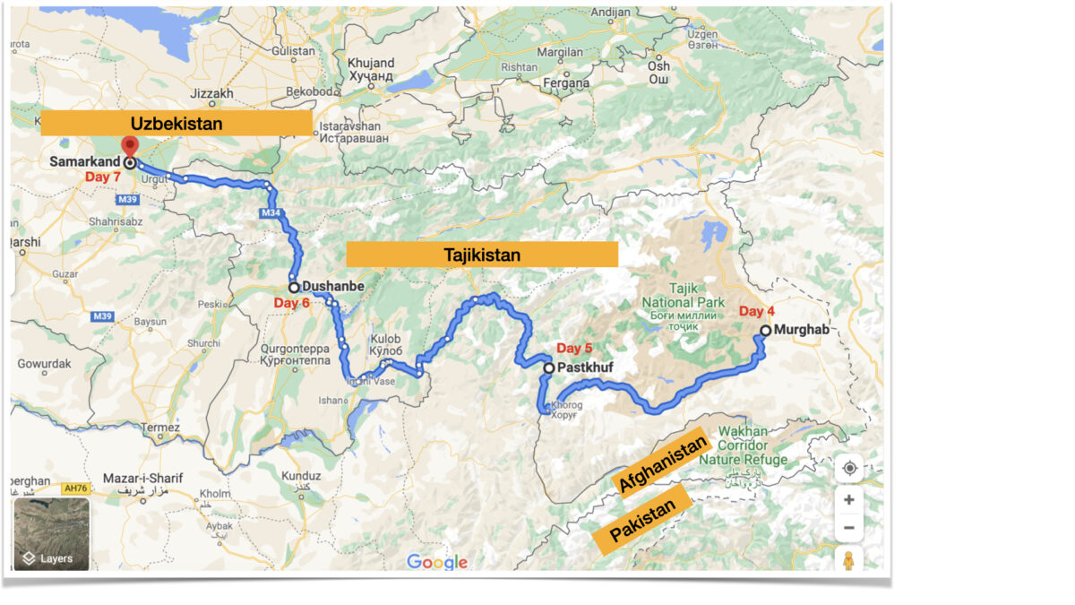
Murghab to Pastkhuf – Day 5

.
Next day, we got up very early and started to ride on the main M41 highway. Previously we had taken a detour through the Wakhan corridor before Kalaikhum. This time, the roads were paved and we started driving back to Rushon, a city in GBAO between Khorog and Dushanbe. We stopped for our lunch in an Indian restaurant in Khorog and headed to Rushon. When we were coming from Khorog, there were Tajikistan soldiers patrolling the area in batches of 15-20. 2 days back, I could see up to 3 soldiers. And on that day, in the Wakhan corridor, in an army Barracks, visible from outside, there were some 100 men in Pathan suits. We felt they might be Afghanis. But it did not cross our mind on what was going on.
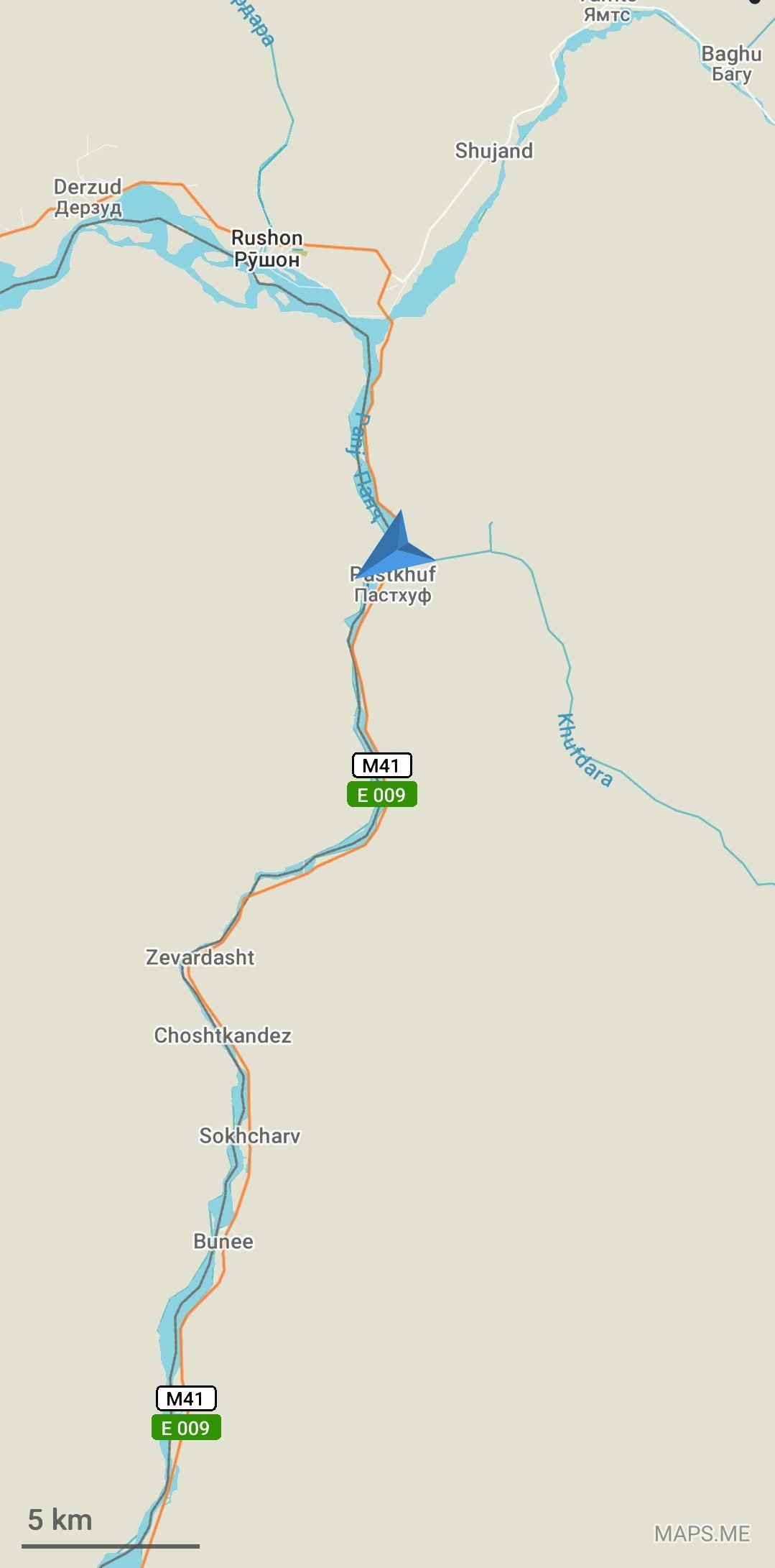
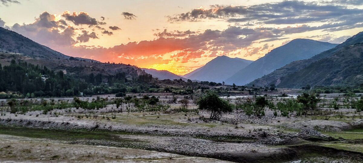
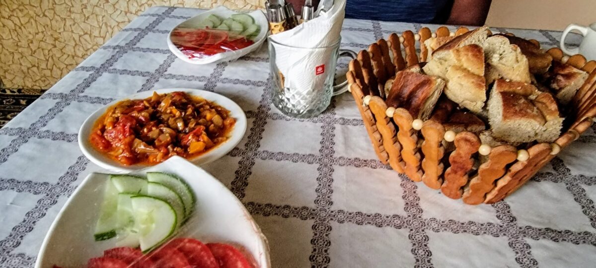
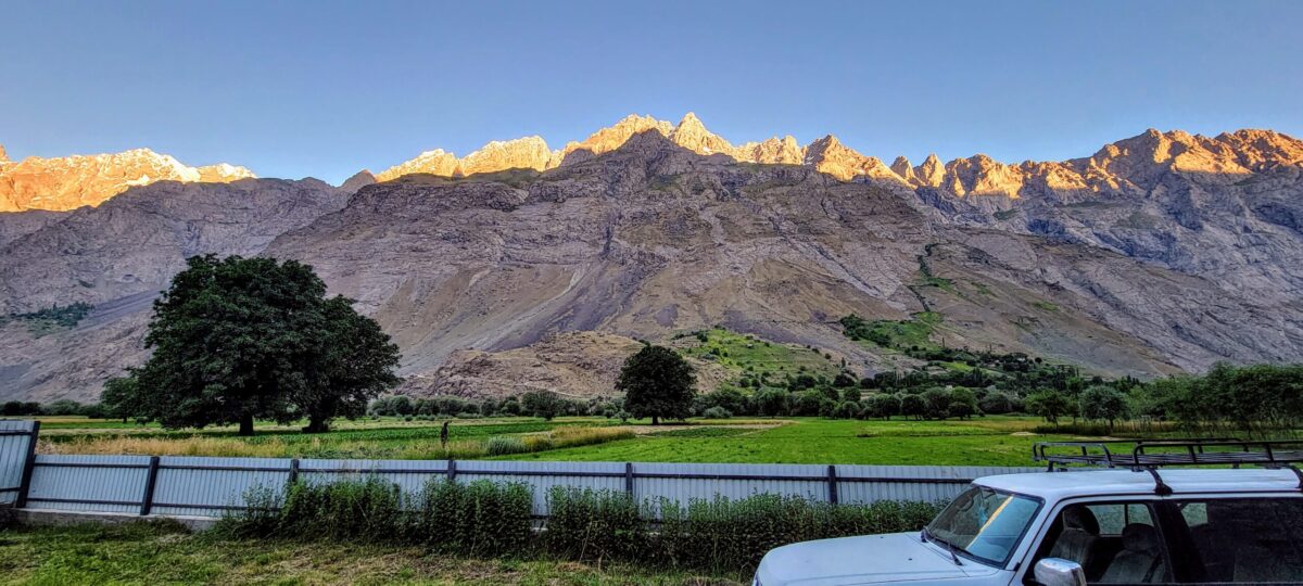
We checked in to a homestay in a village called Pashtkuf near Rushon with the Panj river separating Afghanistan. The villagers told us that across the border, that morning the Taliban had removed the government flag & hoisted theirs. And about 3000 Afghanis had crossed into Tajikistan seeking refuge. But everything remained normal as we went to buy food from a local cafe as they do not serve dinner in the homestay due to the pandemic. Everything was normal in the village. Kids playing and 2 Czech men eating in the cafe. I bought them beers while we discussed the situation and there was no panic or even a murmur of concern.
Pastkhuf to Dushanbe – Day 6
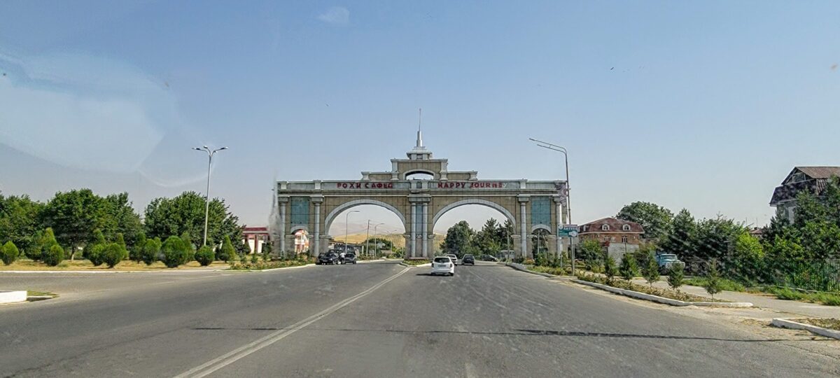
As there was no breakfast served, we left early after watching the sunrise across the river and drove away from the Afghanistan border after a few kms. Now the drive became monotonous as the roads were well paved and we were driving at 120 km/hour. We stopped by at Kulob, another major city in Tajikistan for lunch and by evening we reached Dushanbe preparing to leave for Samarkand, Uzbekistan (will be a separate article) by road the next day after the mandatory COVID test.

Conclusion
Next day, after the mandatory PCR test, I had crossed into Uzbekistan(will share my experience for another day) and headed back to the US after a week. Within a month after my trip, in August, the Wakhan Corridor of Afghanistan collapsed to the Taliban without a fight. The women came under the regressive rule of the Taliban. I could still vividly remember the pretty face of the 19 year old Pamiri girl in the homestay in Langar and her quest for travel. Similar dreams of Girls like her across the border are gone.
In retrospect, do I feel the areas I traveled to are safe after the Taliban takeover in Afghanistan? I absolutely believe it is. In fact, I had offered to take my wife, who is a traveler like me, the same route I traveled through in 2023.
Each travel is an experience, which wisens me. And the trip in Tajikistan had left a lasting impact in me. What started as a quest to retrace the history ended up with a load of humbling experience. As I started to write this article, I had in mind to write the historical aspects of this land, especially the Indian connection, but as I started to write, I felt it would do justice if I write it as a travelogue sharing my experience.
Note: Americans and Indians need Tajikistan visa along with GBAO permit to visit these places. One can file an e-Visa through https://www.visa.gov.tj/index.html. Prepare yourself for the Altitude.